
Know which stand produces in which wind
Northtine is a hunting log built for the tree stand, the blind and the glassing point. Log every sit in a few taps, and over a season it shows you where and when the animals actually move.
 Coming soon
 Coming soon
Works offline · No sign-in · No tracking
Built for before first light
A dark screen that protects your night vision, big buttons that work with gloves on, and nothing that needs a signal.
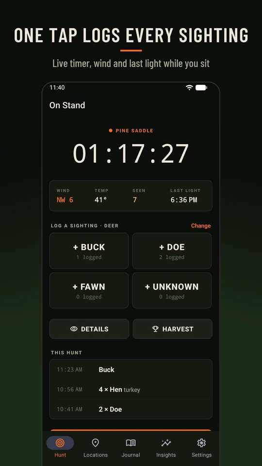
Live hunt timer
Start a hunt at a location and the clock runs while you sit, with wind, temperature and last light up top.
One-tap sightings
Buck, doe, fawn, tom, hen: one tap logs the animal and the time. Add a count or notes when it’s safe to.
Wind on a compass rose
Tap where the wind is coming from, then add speed, temperature and sky.
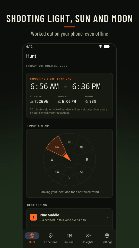
Sun, moon and shooting light
Sunrise, sunset, typical shooting light and moon phase, worked out on your phone with no connection.
Harvest records
Photos taken at the site, the GPS spot, and a hunt album of every harvest by season. Free.
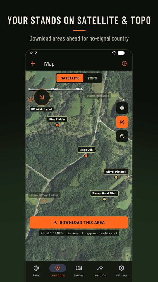
Maps
USGS satellite and topo with your stands pinned. Long-press to add a spot. Download areas for no-signal country PLUS
See what actually works
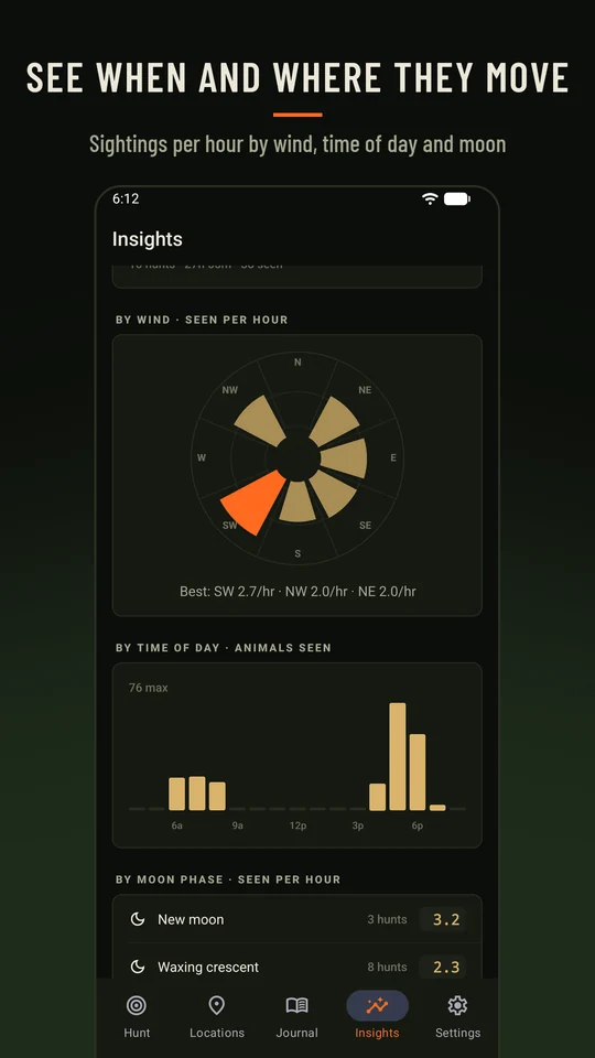
Sightings per hour is the measure: animals seen divided by hours sat. Northtine breaks it down so you can pick the right stand next time.
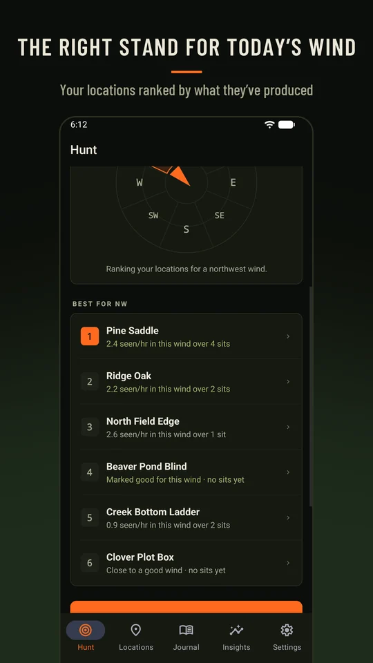
Today’s wind PLUS
Your stands and blinds ranked for the wind you’ve got, from what each has produced and the winds you marked good.
Wind, moon and time of day PLUS
Charts of when and where the animals move, across every hunt you’ve logged.
Season totals
Hunts, hours, animals seen and harvests, plus a table of every location.
Journal
Every hunt with its conditions, sightings and notes, organized by season.
Opener reminders PLUS
A heads-up the evening before each season opener you add.
CSV export PLUS
Your whole log of hunts, sightings and harvests in a spreadsheet.
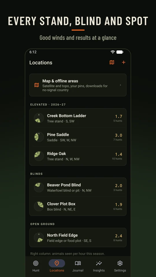
Every stand, blind and spot
Mark the good winds for each one. Still-hunts and spot-and-stalks log the same way as a sit.
Elevated
- Tree stands
- Saddles
Blinds
- Ground, pop-up and box blinds
- Waterfowl blinds and pits
Open ground
- Hilltops and glassing points
- Field edges and food plots
- Waterholes and stalk areas
Free, or Northtine Plus
The free version is a complete hunting log. Plus adds the tools that pick your stand for you.
Free
- Unlimited hunts, sightings and harvests
- Up to 5 locations
- Online satellite and topo map
- Season totals and per-location table
- Harvest photos and hunt album
Northtine Plus
- Today’s wind ranking
- Wind, moon and time-of-day insights
- Unlimited locations
- Offline map areas and the wind overlay
- Past seasons
- Season-opener reminders
- CSV export